Seagrass Mapping Services
Utilizing our advanced uncrewed surface vessels equipped with state-of-the-art sensor systems, we offer comprehensive seagrass mapping to support sustainable marine and coastal management. Our high-resolution data collection can include detailed assessments of:
Seagrass Presence/Absence: Determining where seagrass beds are located and areas where they are notably absent, crucial for ecological monitoring and restoration efforts.
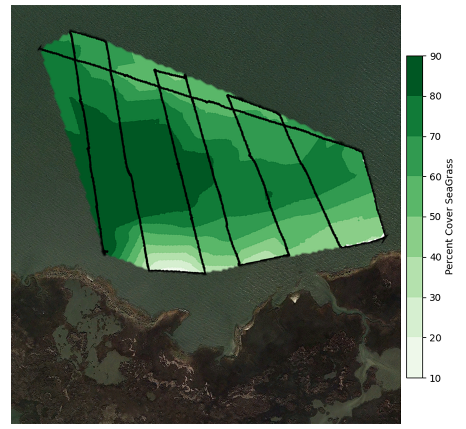
Seagrass Percent Cover: Quantifying the extent of seagrass coverage to help assess ecosystem health and the effectiveness of conservation measures.
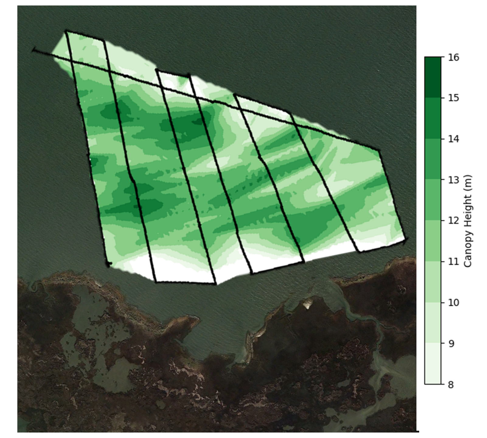
Seagrass Canopy Height: Measuring the height of seagrass, which is vital for understanding habitat complexity and its suitability for marine life.
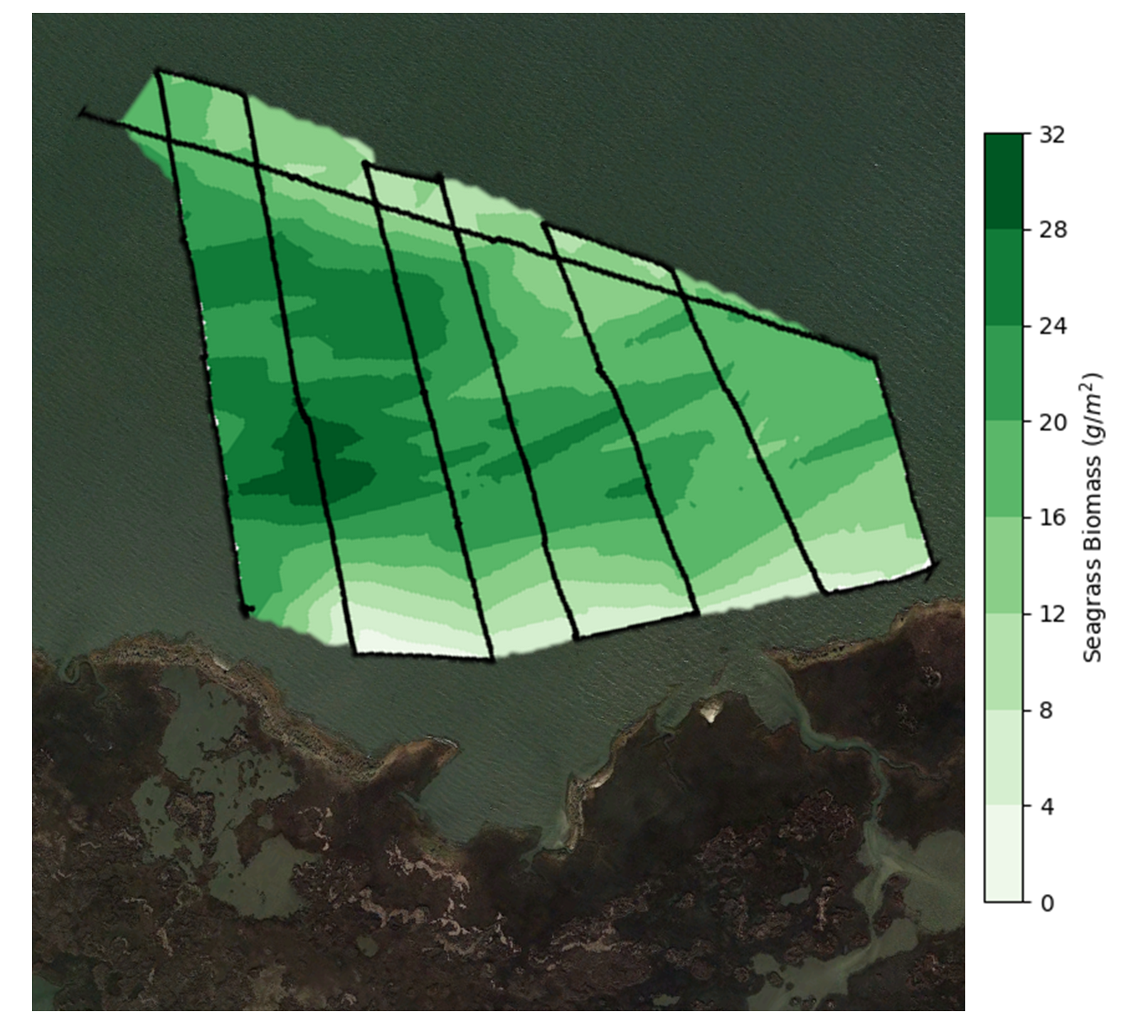
Seagrass Above-Ground Biomass: Estimating the biomass contributes to carbon sequestration studies and helps gauge the overall productivity of the habitat.
Seagrass Production: Assessing the productivity of seagrass areas to understand their role in carbon cycling and their impact on marine ecosystems.
Why is Seagrass Mapping Important?
Seagrass beds are biodiversity hotspots that stabilize the seafloor, improve water quality, and act as key carbon sinks. Monitoring these areas not only aids in their conservation but also supports fisheries management, coastline protection, and biodiversity conservation strategies.
Let’s Work Together
Coastal Monitoring Alliance LLC
Info@CoastalMonitoringAlliance.com