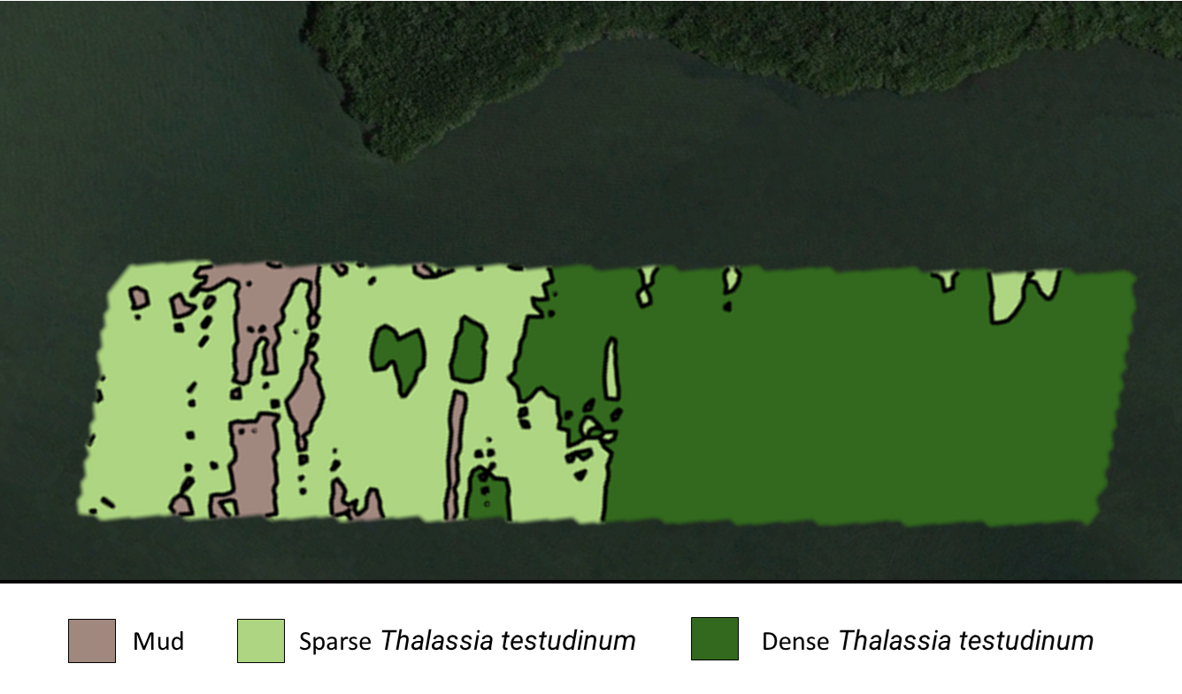
Shallow Water Habitat Mapping
At Coastal Monitoring Alliance, we harness a powerful blend of advanced acoustic observations and high-resolution cameras to deliver unparalleled insights into underwater ecosystems. Our innovative approach is designed to provide:
Detailed and Accurate Data: We capture comprehensive, precise measurements that reveal the complex structures and vibrant life within a variety of habitats.
Near Real-Time Feedback: Our process allows for near real-time data delivery, ensuring timely and actionable insights crucial for effective decision-making.
Access to Challenging Locations: The low draft of our uncrewed surface vessels (USVs) enables us to access even the most shallow and hard-to-reach areas, ensuring no location is beyond our reach.
Supporting a Spectrum of Projects
Our mapping services are essential for a wide range of applications:
Marine Research Initiatives: Enhancing scientific understanding of aquatic ecosystems.
Conservation Projects: Aiding in the preservation and management of vulnerable habitats.
Habitat Restoration Efforts: Providing baseline assessments and monitoring recovery processes.
Site Planning Projects: Assisting in the evaluation and planning of coastal development to ensure environmental compatibility.
Let’s Work Together
Coastal Monitoring Alliance LLC
Info@CoastalMonitoringAlliance.com